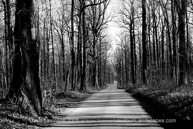
This photo was taken last year during winter on Route 601 which runs along the Blue Ridge bordering western Loudoun. Just out of view is the West Virginia border and a place called Raven Rocks. Research tells me this ridge was covered by hundred foot pines before a great fire took them down. All of the trees shown here are less than sixty years old, which coincides with the fire. The Appalachian Trail runs parallel to Route 601 and is roughly a half mile to the west.
2 comments:
beutiful. kind of haunting picture that makes you want to know what's at the end of the road.
Thanks a ton Markoos!
Post a Comment